
Construction Drone Services & Aerial Mapping in Lincoln, NE | DroneX Services

Construction drone services in Lincoln NE, give builders, owners, and lenders a shared picture of a project that keeps changing under their feet. A site on the growing edge of the city can go from stripped topsoil to framed walls in just a few months, and everyone involved remembers a different version of how far along it is. DroneX Services flies the site on a schedule and returns dated images, maps, and measured quantities that anyone on the project can open and check. Disputes about progress get shorter, draw requests get easier to support, and problems like standing water or damaged roofing show up while there is still time to fix them cheaply.

drone inspections
Get a free Estimate

WHAT CAN WE DO FOR YOU?

Check Out Our Services in Lincoln, NE

Site surveying in Lincoln means something different at each stage of a project, and the services below follow that order. Early on, the concern is the land itself: slopes, wet spots, and access. Midway, it becomes volumes, haul roads, and progress. At the end, owners want proof that roofs, grading, and drainage match the plan. Five sections follow, each named for the stage it fits. Find the stage you are in. If your project spans two, mention both when you call and we will build one plan around them.

Agricultural Drone Services

Agricultural drone services in Lincoln often start on an acreage, where an owner wants to know where the house, well, and driveway should go before any dirt moves. A map shows how water crosses the lot, where the ground drops toward a drainageway, and how a shelterbelt or terrace will affect the building. Contractors quote with fewer surprises, and owners see the lot as the excavator will. Staking and legal boundaries stay with a licensed surveyor.

Drone Sales

Drone sales in Lincoln is where a contractor’s first drone purchase gets complicated, because accuracy depends on setup. Measuring a stockpile within a few percent is easy. Checking finished grades to tight tolerances is harder and calls for ground control points and checkpoints. Decide what your contracts actually require before you pick hardware. We sell mapping drones and can explain what accuracy each setup delivers and what it costs to run.

Drone Inspection Services in Omaha, NE

Drone Inspections

Industrial drone inspection services in Lincoln support expansions before the first excavator arrives. A plant that wants to add a bay, a rail spur, or a new line needs a record of existing conditions: pipe racks, loading docks, overhead lines, and clearances for crane paths. Flights capture all of it with little disruption to operations, and the images give designers and contractors one reference. A later flight checks the new work against that record.

Construction Drone Services

Construction drone services in Lincoln earn their keep most clearly at draw time. A lender, an owner’s representative, and a general contractor often disagree about percent complete, and each has a point. A monthly flight from fixed positions gives all three the same dated, location-tagged images to work from, with the previous month’s set beside it. Work in place, materials on site, and stalled areas show at a glance, which shortens the debate.

Search and Rescue

Search and Rescue services in Lincoln sometimes reach emergencies on or near a job site. A storm-battered wall, a partial collapse, or flooding in an open excavation can leave responders unsure what waits inside the fence. Call 911 first. Responders can then request an overhead recording to judge the hazards before anyone enters, and we fly whatever pattern the incident commander assigns. Footage stays with the agency that asked for it.

construction drone services

LEARN MORE ABOUT US

Who are we?

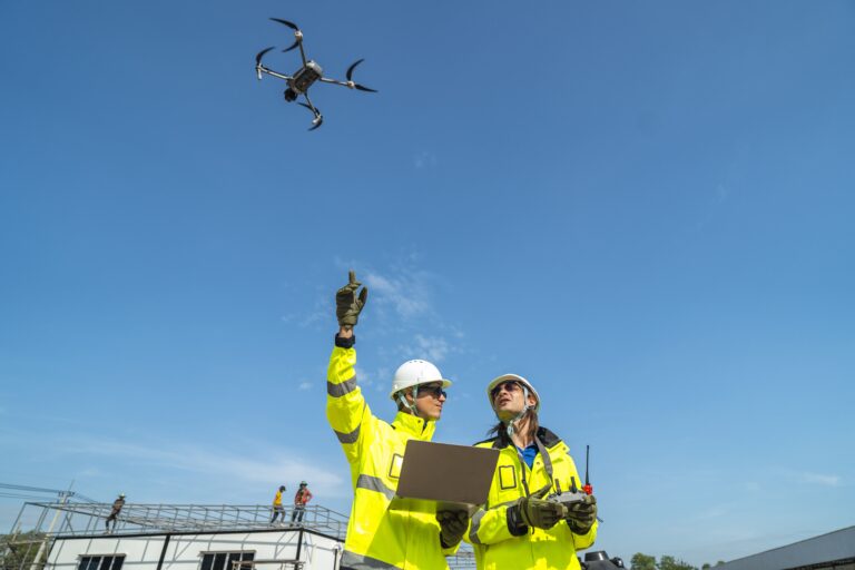
Construction drone services in Lincoln from DroneX Services run smoothly when the pilot acts like a member of the site team. That means attending the safety orientation, wearing the required gear, and checking in with the superintendent before the aircraft leaves its case. We ask where the lay-down yard is, which gate trucks use, when concrete deliveries arrive, and where the crane swings, then schedule the flight around them. Radios stay on during the flight. If a lift starts, we land and wait. When we finish, every dataset is labeled with the date and the project phase, so the record makes sense to someone who joins the job six months later.


Why Choose DroneX

Construction site aerial mapping in Lincoln is only useful when you know how accurate it is, so we say so up front. Targets placed on the ground, checkpoints that were left out of processing, and a clear note on the margin of error go with every map that will be measured. Simple progress photos need none of that. We recommend the lightest method that answers your question. When a job needs a surveyor, we tell you. Every number we give comes with the method behind it. Four short notes follow.

Reasons to Trust

Construction drone services in Lincoln include a short site safety briefing before launch, so every crew on the job knows when and where we are flying.

Your Best Choice

Construction site aerial mapping in Lincoln gives owners and lenders a clear, current picture of progress without a muddy walk around the whole site.

Right Choice for You

Industrial drone inspection services in Lincoln and building-site flights are scoped to the project, from one map to a program that lasts the whole job.

Professional

Property drone inspection services in Lincoln follow FAA rules and your site’s safety plan, with airspace checks done before the aircraft leaves the case.

Google Review

Write a Review

Webb Wallace
★★★★★
“Exceptional service! The drone team provided detailed aerial data that made farm management so much easier. Highly recommend their expertise.”
Renae Stringer
★★★★★
“Professional and reliable! Their inspection drones saved us time and gave accurate results we could trust.”
Erik Young
★★★★★
“Outstanding experience from start to finish. The team’s knowledge and technology exceeded our expectations and delivered great results.”

Top Rated Construction Drone Services in Lincoln, NE

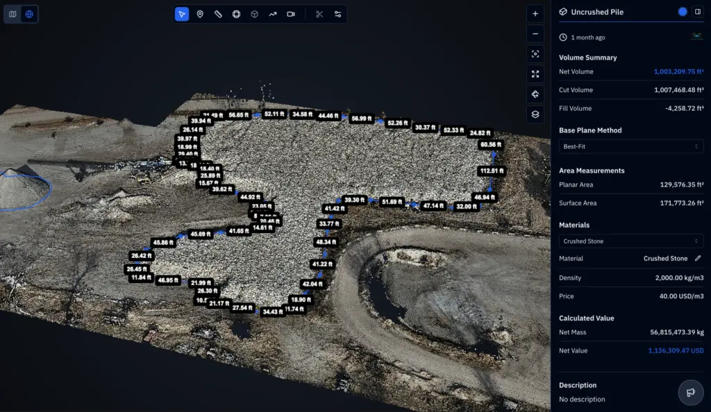
Construction site aerial mapping in Lincoln produces more than a pretty picture. A typical flight yields one overhead map of the whole site, an elevation model with contour lines, and photos taken from fixed positions, each tied to ground targets so measurements line up from visit to visit. Teams use the elevation model to check pads against design grades, find low spots, and see where haul roads are rutting. After heavy rain, the same flight shows whether a silt fence, inlet protection, and stabilized entrances are holding along the whole perimeter. Drone images add to required on-site stormwater inspections without replacing them. Stockpile volumes can be measured to reconcile haul tickets.

Check Out Our Gallery

Proudly Serving Lincoln, NE & Local Farming Communities

Site surveying in Lincoln covers a city that keeps growing outward and building upward. Subdivisions and commercial pads appear on the edges, while infill projects downtown and near the university work in tight spaces with little room to stage materials. We fly projects across Lincoln, Waverly, Hickman, Bennet, and Walton, and farther out near Greenwood, Ashland, and Elmwood. Parts of the Salt Creek and Antelope Creek drainages carry floodplain rules, so drainage documentation matters. Controlled airspace around Lincoln Airport covers part of the city, so every site gets an FAA airspace check, with LAANC authorization requested where it applies.

drone inspection services

Call Us Now

Planning a build and want construction drone services in Lincoln? Call or message DroneX Services with the project address, the stage you are in, and who needs the information. Ask for a one-time map if you are pricing a job, or a recurring schedule if you are managing one. Send drawings or a site plan when you have them, and mention gates, overhead lines, and any area we should avoid. Conditions shift daily on a live site, so give us someone who can say what is happening today. You get a proposed start date, the price in writing, and a list of what will be delivered. Not sure which service fits? Sketch out the job and we will suggest a plan.

Frequently Asked Questions

How Can Construction Drones Help Monitor a Project in Lincoln, NE?

A regular flight shows the whole site at once: foundations, framing, haul roads, material storage, and drainage. Photos and maps are dated, so you can compare this week with last month and see what is finished, what slipped, and what has changed.

Yes, with limits. During a flight the controller screen shows a live feed, and we can share it with your superintendent on a tablet or over a video call. Maps and 3D models need processing, so they arrive after the flight lands. Ask when you book.

Flights from the same positions create matched photos and maps. Lay one over another and you can see slabs poured, walls lifted, stockpiles moved, and areas that have not changed. That gives owners and lenders a factual read on percent complete.

Yes. Property drone inspection services in Lincoln can reveal standing water, failing silt fence, rutted haul roads, uneven grading, damaged roofing, and misplaced materials. Early catches keep repairs small, and someone on site confirms the cause.

How Can Aerial Monitoring Help Keep Construction Projects on Schedule?

Regular aerial updates let managers confirm deliveries, check trade sequencing, and spot weather damage sooner. Owners get a current picture without a site walk, and a short flight after a storm shows whether crews can restart or must clean up first.

A drone views fall hazards, fencing, crowded lay-down areas, and excavation edges without sending anyone near them. Industrial drone inspection services in Lincoln do the same inside plant fences. It supports your safety team and never replaces it.

Construction site aerial mapping in Lincoln delivers an overhead site map, an elevation model with contours, dated photo sets, short video clips, and stockpile volumes on request. Files open in common viewers, and full-size originals are available too.

Pricing for construction drone services in Lincoln follows site size, flight frequency, deliverables, and travel time. One small lot mapped once costs a fraction of weekly flights over a big campus. Tell us the site and your goal for a written quote.

CONTACT US

You Can Contact Us Any Time