

Construction Drone Services in Omaha, NE | DroneX Services

Construction drone services in Omaha, NE, begin with a plain fact: nobody on a job site can see all of it at once. A foreman sees the slab at their feet. An owner sees a progress report a week late. A drone sees the whole site in a few minutes, and the pictures show what is built, what is behind, and where water is collecting. DroneX Services flies construction sites across the metro, from warehouse pads to apartment lots, and delivers aerial photos, maps, and measurements that project teams can compare week to week and month to month. Flights are timed around pours, inspections, and weather, so the data arrives while a decision is still open.

aerial mapping
Get a free Estimate

WHAT CAN WE DO FOR YOU?

Check Out Our Services in Omaha, NE

Construction site aerial mapping in Omaha changes purpose as a project moves from dirt to drywall. Before grading, the question is about the land. During earthwork, it is about volumes and drainage. Once walls rise, the focus shifts to progress and quality, and at closeout it turns to roofs, facades, and warranties. The five services below follow those stages, from farmland assessment to emergency help. Read down the list until you find where your own project stands today. Some projects fit two.

Agricultural Drone Services

Agricultural Drone Services in Omaha often begins on former farmland, because many new subdivisions and warehouse parks replace cropland at the edge of the metro. Our agricultural drone team can map drain tile scars, wet spots, and old waterways that a plan set may not show. Landowners selling a field also use the flights to document drainage before a developer’s crew arrives. What a field did before grading often predicts how the finished lot will behave.

Drone Sales

Drone Sales in Omaha include hardware sales for contractors who prefer to fly their own sites. DroneX Services sells job-site drones and explains what drives the choice: RTK positioning for tighter maps, enough batteries for a full day, and software that turns photos into models. We also walk buyers through Part 107 certification, Remote ID, and airspace limits around the metro. If hiring us costs less than owning, we say so.

Drone Inspection Services in Omaha, NE

Drone Inspections

Industrial drone inspection services in Omaha keep working long after the ribbon is cut. Plant roofs, stacks, storage tanks, conveyor galleries, and rooftop units all get close-up imagery without anyone erecting scaffolding. A distribution center facilities manager can compare this spring’s roof photos with last fall’s and see whether a seam moved. Findings arrive as a short, ranked report that maintenance crews can work through at their own pace.

Construction Drone Services

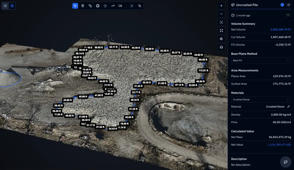
Construction drone services in Omaha center on a repeatable flight over the same site every week or two. Each visit yields a stitched map, a 3D model, and fixed-position photos, so a superintendent can scroll back to the day footings were poured. We measure stockpiles, compare cut and fill against the plan, and flag pondering before it turns into rework. Legal boundaries belong to a professional land surveyor, and we work alongside one when needed.

Search and Rescue

Search and Rescue services in Omaha include a quick damage read after a storm, fire, or structural scare on a site. Heat signatures, shifted framing, and torn roof edges show up on screen while the ground stays clear. Owners, insurers, and responders get a recorded view of the scene first. Footage can be replayed later for claims and repairs. If someone is hurt or missing, call 911 before anything else. We assist agencies when they ask us to.

construction drone services

LEARN MORE ABOUT US

Who are we?

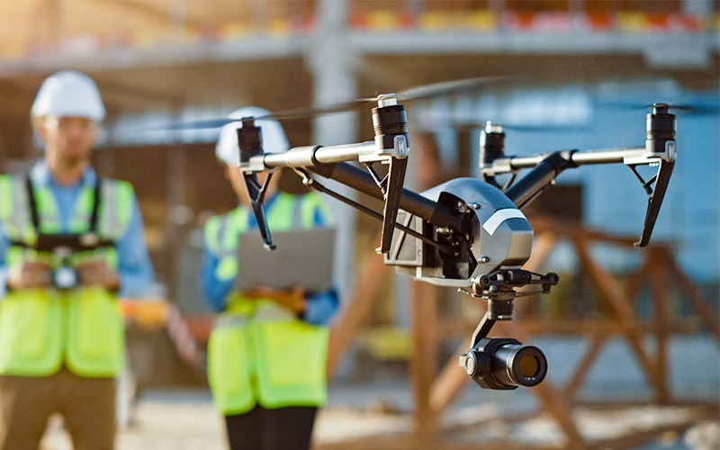
Construction drone services in Omaha rest on the plan set, so DroneX Services staff site flights with people who know what a grade stake and a pour sequence mean. A map nobody can place on the plan is not much use. We ask for the drawings, the schedule, and the name of whoever will use the data. Flight altitude, image overlap, and ground control then follow from the decision at hand, whether that is a bid, a draw request, a stormwater walk, or a punch list. Between visits we file everything by date and area, so a question in month six still has an answer. Superintendents rarely have time for long emails, so ours are short and specific.

Why Choose DroneX

Construction site aerial mapping in Omaha earns its keep through repetition. We fly fixed lines at agreed intervals, name every dataset by date and area, and settle the turnaround before the first flight. Pilots attend site orientation and keep the aircraft clear of cranes, haul trucks, and crews. On a normal project, the first visit sets a baseline, later ones measure change, and the last one records what was actually built. Four short points follow on what you can count on from DroneX Services.

Reasons to Trust

Construction drone services in Omaha leave a dated trail: every flight, map, and photo set is labeled by date, area, and pilot for later reference.

Your Best Choice

Site surveying in Omaha goes faster from above, saving walking time, and the team gets measurements it can check against the plan before the next pour.

Right Choice for You

Property drone inspection services in Omaha and site mapping share one crew, so a single call covers the lot, the roof, and the closeout punch list.

Professional

Flights meet FAA requirements, include site safety orientation, and keep a spotter near cranes and moving equipment so crews can keep working safely.

Google Review

Write a Review

Webb Wallace
★★★★★
“Exceptional service! The drone team provided detailed aerial data that made farm management so much easier. Highly recommend their expertise.”
Renae Stringer
★★★★★
“Professional and reliable! Their inspection drones saved us time and gave accurate results we could trust.”
Erik Young
★★★★★
“Outstanding experience from start to finish. The team’s knowledge and technology exceeded our expectations and delivered great results.”

Top Rated Construction Drone Services in Omaha, NE

Property drone inspection services in Omaha add a quality check to the construction record. Before closing, lenders and owners want to know the roof is sound, the flashing is tight, and the lot drains away from the building. A drone shows all of that without a lift or a ladder. Near the end of a one-year warranty, the same flight can catch early membrane failures while the contractor is still on the hook. Industrial drone inspection services in Omaha run on the same pattern for plants and warehouses. On a new building, we compare what stands on site with what the drawings call for. Each report pairs annotated photos with a plain list of what to repair, what to watch, and what is fine.

Check Out Our Gallery

Proudly Serving Omaha, NE & Nearby Nebraska Communities

Site surveying in Omaha covers a lot of ground, and so do we. DroneX Services flies projects in West Omaha, Elkhorn, Millard, La Vista, Papillion, Gretna, and Bellevue, plus Plattsmouth, Fremont, and Blair. Growth along the Interstate 80 corridor keeps warehouse pads and apartment lots coming, and sites in the Papillion Creek watershed need close attention to detention basins and erosion control. Loess soils wash easily after a heavy storm. Frozen ground can hide ponding until the thaw, which is when a baseline map earns its keep. Airspace around Eppley and Offutt is controlled, so we confirm authorization and LAANC before each site visit.

drone technology for construction

Call Us Now

Ready for construction drone services in Omaha? Send the address, the site plan, and the schedule, and we will outline what the first flight could produce. Say whether you need a one-time map for bidding or a recurring program for the length of the job. Mention who will use the data, such as an owner, an engineer, or a lender, so we can format files that open in their software. Tell us about access too: gates, haul roads, and where the pilot can safely stand. Active sites change daily, so give us a contact who knows today’s conditions. Still bidding? Ask which data would sharpen your number. Pricing is put in writing before the first flight.

Frequently Asked Questions

How Can Construction Drones Help Monitor a Job Site in Omaha, NE?

Construction drone services in Omaha give project teams a regular aerial view of the entire site. Flights record grading, foundations, framing, roofing, and material storage, and the images can be stitched into a map for measuring and comparing. Instead of relying on walk-throughs and memory, the team has a dated record that shows what changed since the last visit and what is still open.

Industrial drone inspection services in Omaha and construction mapping both suit warehouses, apartment communities, retail centers, schools, medical offices, roads, utilities, and subdivision grading, as well as renovations where roof or facade access is difficult. Large footprints and fast schedules benefit most. A small residential job can use a single flight for a roof or lot check. If your project type is not listed, ask. The method adapts.

Construction site aerial mapping in Omaha pays off on a schedule, so regular progress flights are a core part of what we do. Most clients choose weekly, biweekly, or monthly visits, timed to pours, inspections, or draw requests. Each flight follows the same lines, which makes comparisons reliable. We also fly on demand after a storm or a major milestone, weather and airspace permitting.

Drone views reveal issues that are hard to see from the ground: standing water, silt fence failures, tire ruts, uneven grading, missing roof sections, and stockpiles drifting from where the plan puts them. Spotting these early lets a superintendent fix them while the correction is cheap. Some problems still need a person on site, but the aerial record tells that person where to look.

Can Drone Footage Be Used for Construction Progress Reports and Client Updates?

A progress report from DroneX Services typically includes dated aerial photos from fixed positions, a stitched site map, and notes on what changed. Depending on the scope, we add stockpile volumes, cut and fill comparisons, and annotated problem areas. Files arrive as PDF, JPG, and GeoTIFF, which owners, lenders, and engineers can open without special software.

Drone-based site surveying in Omaha can support safety reviews, roof and facade checks, and drainage studies by showing conditions from above. We photograph perimeter fencing, haul roads, fall hazards, ponding, and erosion. These images inform your own safety and engineering staff. They do not replace a licensed engineer’s judgment or a surveyor’s boundary work.

Aerial photos and video are included in most construction packages, along with the maps and measurements. You receive high-resolution stills, short video clips for owner updates, and the original files. If you need specific footage, such as a fly-through for marketing or a close look at one wall, tell us when you book so the flight plan can account for it.

Construction drone pricing in Omaha depends on site size, how often we fly, the deliverables you need, and travel time. A single map of a small lot costs far less than a weekly program on a multi-building campus. Send us the address and your goals, and we will give you a clear quote that lists what is included before you commit.

CONTACT US

You Can Contact Us Any Time