On most projects, do you run into the same problems—limited visibility of the site, progress reports based on opinion instead of data, and a constant risk of safety incidents? At the same time, clients push for tighter programs and cleaner documentation. Drone services give you hard visual data instead of guesswork, so you can manage your jobs with facts, not assumptions.
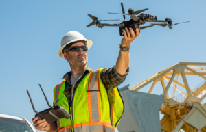
At DroneX Services, we see these issues every day on the sites we support. When we bring structured drone flights and clear reporting into a project, teams suddenly have current aerial views, accurate measurements and a visual history of the build. They use this to plan earthworks, track production, inspect high‑risk areas and support claims. That is why drones have moved from “nice to have” marketing shots to a practical tool that directly affects cost, time, safety and quality.
Drones in Construction: What They Actually Do for You
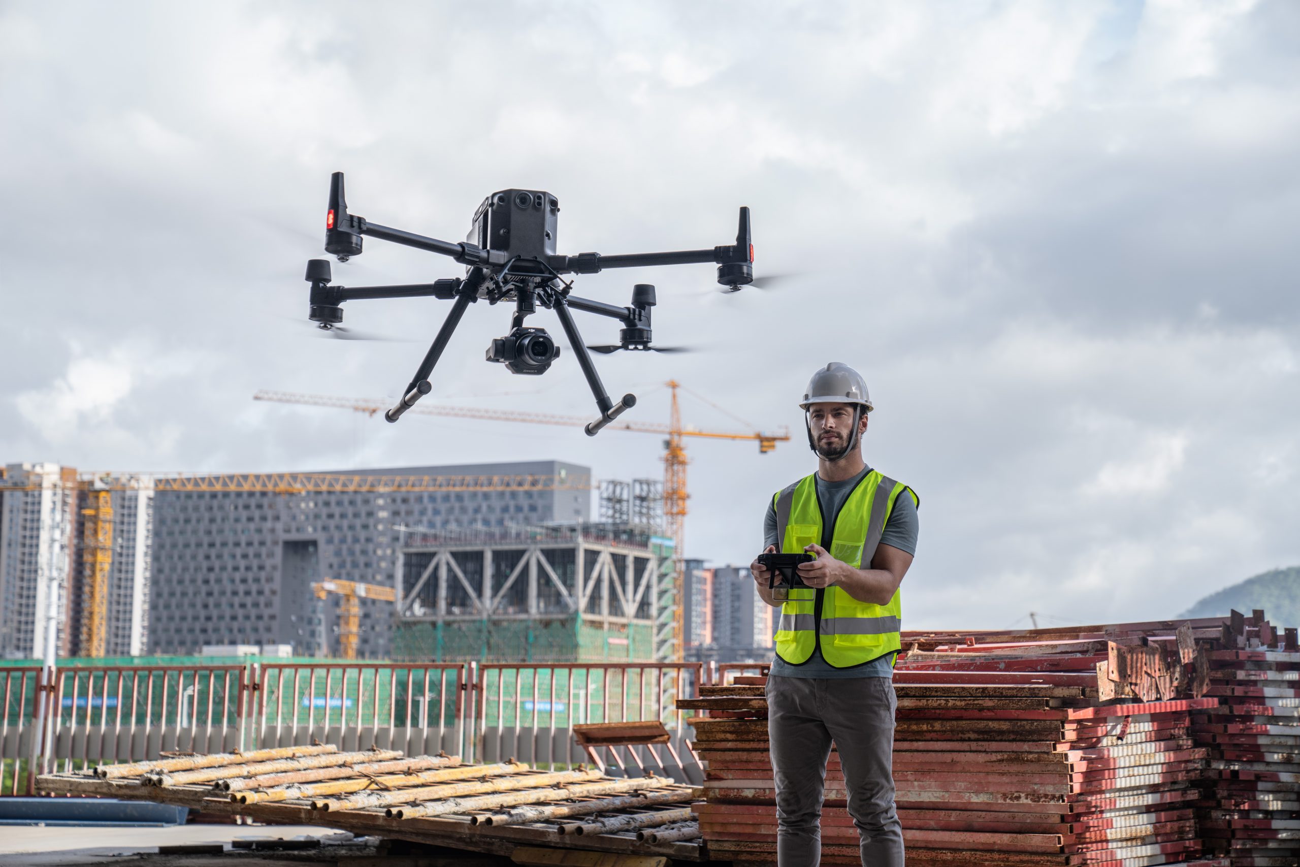
On-site, a drone is basically a flying survey camera. The pilot flies a pre‑planned route over your project while the drone captures hundreds of overlapping images. Software then stitches those images into a single, measurable map and 3D model that your team can open on any laptop or tablet.
Instead of walking the whole site, you zoom in on any area from above, take measurements and see how the different pieces fit together. You can line this data up with your CAD drawings, BIM model and construction program. That way, design, plan and real‑world site conditions stay closer together throughout the job.
Faster, More Accurate Site Surveys and Mapping

Traditional surveys on large or rough sites take time. Crews walk steep slopes and uneven ground with equipment, capture point after point, and then send the data back for processing. You pay for those days on site, and you still end up with a limited number of measured points.
With drones, you cover the same area in a fraction of the time and capture far more detail. A single flight can map a big greenfield plot, an industrial expansion or a long section of road, and give you a dense point cloud plus a high‑resolution image of the whole surface. When you tie this into a few well‑placed ground control points, the accuracy is good enough for serious design and planning decisions.
Because drone surveys are quick to repeat, you can update your terrain model every time you have a major change in levels. Designers and planners no longer rely on one old survey while the ground keeps getting cut and filled. That reduces surprises, rework and arguments about who changed what on site.
Reliable Progress Monitoring and Clear Reporting
Once work starts, you need a simple way to see where you are against where you should be. Site walks and mobile phone photos give you pieces of the picture, but not the whole thing. Different supervisors can come back from the same site with very different impressions of progress.
Regular drone flights fix this. When you fly the same route every week or two, you create a visual timeline of the project. You put two dates side by side and you immediately see which areas moved, which stayed still and where work backed up. Earthworks, structural frames, slabs, facades, services routes and laydown areas all show clearly from above.
In progress meetings, instead of debating from memory, you put the latest aerial image or model on the screen and discuss real, visible facts. You then attach a couple of annotated screenshots or a short fly‑through to your client report. That single step removes a lot of confusion and makes conversations about delays or changes more straightforward.
Making Your Site Safer
Many inspections and checks still rely on sending someone to a height or near a risky edge just “to have a quick look.” Every time you do that, you accept a higher chance of a fall or near‑miss. A drone can handle most of that visual inspection work without exposing a person to the same risk.
You can fly close to roofs, facade lines, crane ties, parapets, temporary formwork and high retaining structures and capture detailed images or video. The supervisor stays safely on the ground and reviews the footage on a tablet. Only when you see a real issue do you send a team up with the right equipment and plan.
Drones also help you assess unstable areas after heavy rain or major excavation. Before you open access, you fly the area, look for movement, pooling water or obvious failures, and then brief the crew. Over time, this approach cuts the number of hours your people spend in dangerous positions just to check something.
Real Savings in Time and Cost
Drone services save you time first, which then converts to money. A topographic survey that took a field crew several days often drops to a single morning of drone flying plus some office processing. Your surveyors still play a key role, but they spend more of their time checking and using data instead of walking the whole site.
You also reduce the use of expensive access equipment that you previously needed only for visual checks. If you rented a MEWP or built extra scaffold just to photograph an area or take simple measurements, a drone flight usually replaces that. You still use access gear for physical work, but not for quick inspections that a camera in the air can handle.
The biggest savings often come from catching mistakes early. When you fly regularly, you see misaligned works, missing embeds, wrong levels or unsafe storage regimes before they spread. Fixing one wrong pour or one mis‑set line in the same week costs far less than discovering it at the fit‑out or commissioning stage.
Stronger Quality Control and Solid Documentation
Good quality control depends on seeing what has been built and having proof of it later. Drones support both parts. From above, you can spot pattern issues that are hard to see from the ground, such as misaligned rows, uneven spacing, incomplete waterproofing zones or inconsistent backfill areas. You focus your on‑foot inspections on the locations that look suspicious in the aerial view.
Every flight also creates a dated snapshot of the whole site. Months or years later, if a dispute arises about when an area was completed, who caused a delay, or whether damage existed at a certain time, you open that week’s imagery and check. The pictures give you an objective record that often settles arguments quickly.
At handover, you can include selected aerial images and final orthomosaic maps in the as‑built package. The client and facility team then see exactly where underground services run, how you sequenced structures and how the finished layout actually looks on the ground. That makes later maintenance, tie‑ins and expansions far easier to plan.
Better Communication with Every Stakeholder
Not everyone reads drawings or schedules comfortably, but almost everyone understands a clear photograph. Drone imagery turns abstract conversations about “Zone 3 earthworks” or “Block B facade” into concrete visuals that clients and non‑technical stakeholders can follow.
When you show an updated overhead view, clients see the footprint, sequence and current status in seconds. Investors or lenders can review a monthly image and understand progress without long technical notes. Regulators and local authorities can check that you kept environmental buffers, site entrances and temporary protections in place at specific dates.
Inside your own team, you use drone views in inductions, toolbox talks and daily briefings. New staff learn the layout faster, and safety talks become more focused because everyone can see the exact high‑risk spots on screen. Your marketing team can also reuse finished aerials and time‑lapse sequences when they present your track record to new clients.
Fitting Drone Data into Your Existing Workflows
Drone services deliver real value only when you plug them into the normal way you run projects. Pre‑construction, you use a drone survey as your base for design, access planning and quantity checks. Your design team works from actual site levels and obstacles, not from rough assumptions or very old surveys.
During construction, you set a clear routine. For example, you might decide that every Wednesday morning the drone flies, and by Thursday’s coordination meeting the processed data is ready. Planners, QSs and site managers open the same viewer, mark up issues, plan next week’s work and adjust the program or logistics using fresh information.
At closeout, you treat the final drone map and selected images as part of the formal handover documentation. If the client wants, you can also deliver a simplified 3D model of the final state tied to coordinates. This makes your workflows more consistent from project to project, because everyone knows when drone data comes in and how to use it.
Working Within Regulations and Site Safety Rules
Drones sit at the intersection of aviation rules and construction safety rules, so you must treat them properly. In most regions, commercial flying requires licensed pilots, documented procedures and valid insurance. You also need to respect altitude limits, keep clear of airports and follow any local no‑fly restrictions.
On-site, you plan drone work like any other piece of plant. You agree safe flight paths and times around crane lifts and heavy operations, you brief the crew so no one gets distracted by the drone, and you include the activity in your method statements and risk assessments. When you either hire a good provider or train an internal team well, the drone becomes a controlled, low‑risk part of your standard operations.
How to Choose a Drone Service Provider

If you outsource, look for a partner who actually understands construction, not just photography. When you speak with them, ask them to show examples from jobs similar to yours and walk you through how site teams used those deliverables. You want someone who talks naturally about cut‑and‑fill, progress tracking, claims support and as‑builts, not only about “nice shots.”
Make sure their outputs fit your systems. Check that they can deliver georeferenced maps, 3D models and reports that you can open in your CAD, BIM and planning tools. Clarify turnaround times from flight to usable data, and confirm their licenses, insurance and safety processes. A strong provider will also help you design a sensible flight schedule and reporting format, so the data slots straight into your project routines.
When to Call a Professional Drone Team
Drone data makes the biggest difference when your project is large, complex or spread out. If you manage major earthworks, multiple buildings, heavy civil works or tight deadlines, it usually pays to bring in a professional drone team instead of trying to cover everything with manual site walks and ad‑hoc photos.
If you are working in eastern Nebraska, you can hand this workload to DroneX Services. We provide construction drone services in Omaha, NE and Lincoln, NE, for contractors and developers who want reliable mapping, progress tracking and inspection support without adding extra tasks to the site team.
Local Construction Drone Support Across Nebraska
Regional projects bring extra challenges: long travel times, multiple work fronts and constant earth movement. Regular drone flights help you keep control of haul roads, stockpiles, laydown areas and structures across the full footprint, even when sites sit far from your main office.
To support these kinds of jobs, DroneX Services offers dedicated construction drone services in Kearney, NE. Whether you are building industrial facilities, infrastructure or large commercial projects, we give your team consistent aerial data and clear visuals they can use in planning, coordination and reporting.
The Direction of Travel: From Add-On to Standard Tool
Software is already learning to read drone imagery on its own. It can recognise built elements, measure areas and compare progress against your model and program. That means you will spend less time manually measuring and more time using automatic progress metrics and deviation alerts that come directly from drone flights.
At the same time, autonomous drones and docking stations are making regular, repeatable missions easier to run. For construction companies, the message is clear: drones are shifting from an optional extra to a standard control tool on serious projects. The teams that build this capability now will run safer sites, catch issues earlier and present clearer evidence to clients and partners on every job.